Suikerboschfontein Hiking Trail

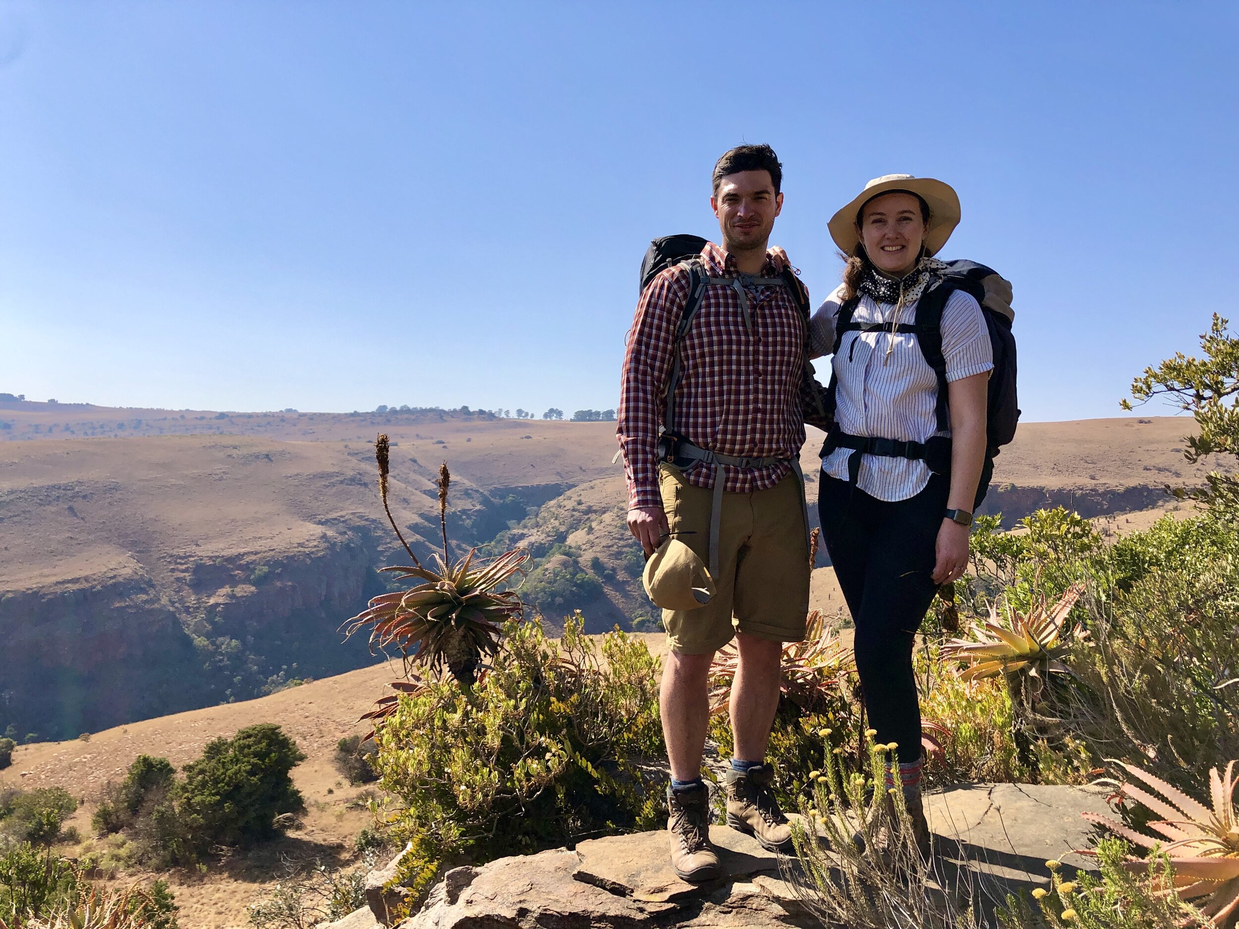
Ben at the start of the hike: Oom Japie’s
Let’s say this first: we love living in Johannesburg. We’re big fans of the energy, the green suburbs, its parks and nightlife. But my God, it’s not where you want to live when Covid-19 lockdown regulations mean you can only travel provincially.
While our friends in KwaZulu-Natal and the Western Cape were camping, hiking and swimming, we were stuck staring at a map of the smallest province in South Africa. It was pretty dire.
So, when the country moved to level two lockdown we were ready to get out. Luckily, we had a booking for one of our favourite overnight hikes in Mpumalanga: Suikerboschfontein. We had first done the hike in 2014, when we had just moved from Cape Town to the big smoke. It was our first experience of overnight hiking and made a lasting impression.
It will take you about 2.5 to 3 hours to drive from Johannesburg to the Oom Japie dormitory where you’ll sleep on Friday night. It’s pretty rustic, but clean with everything you need. Arrive with low expectations and you’ll be fine. There is a large braai area with a gas stove. Light the donkey boiler, if you want a hot shower.
Day 1
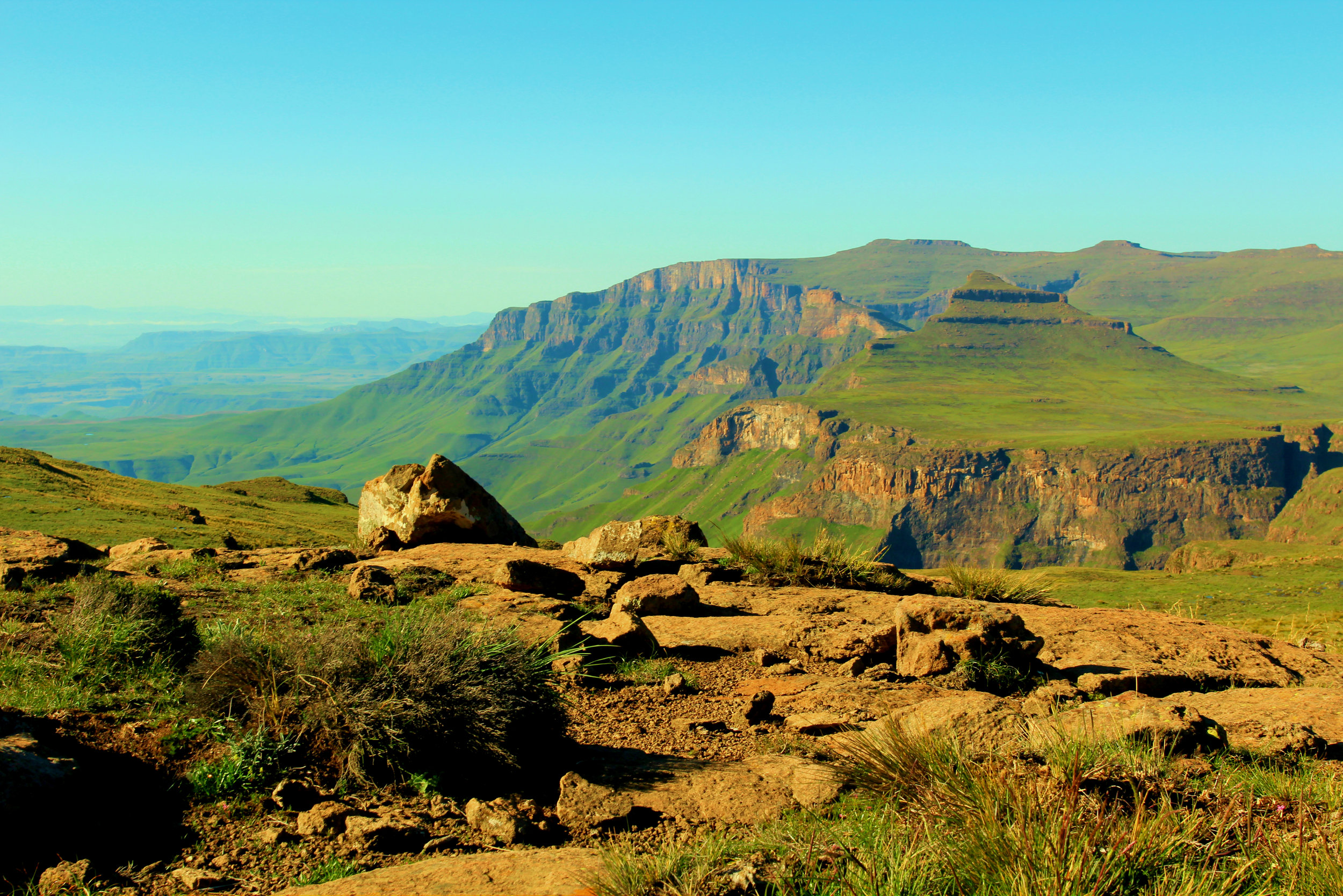
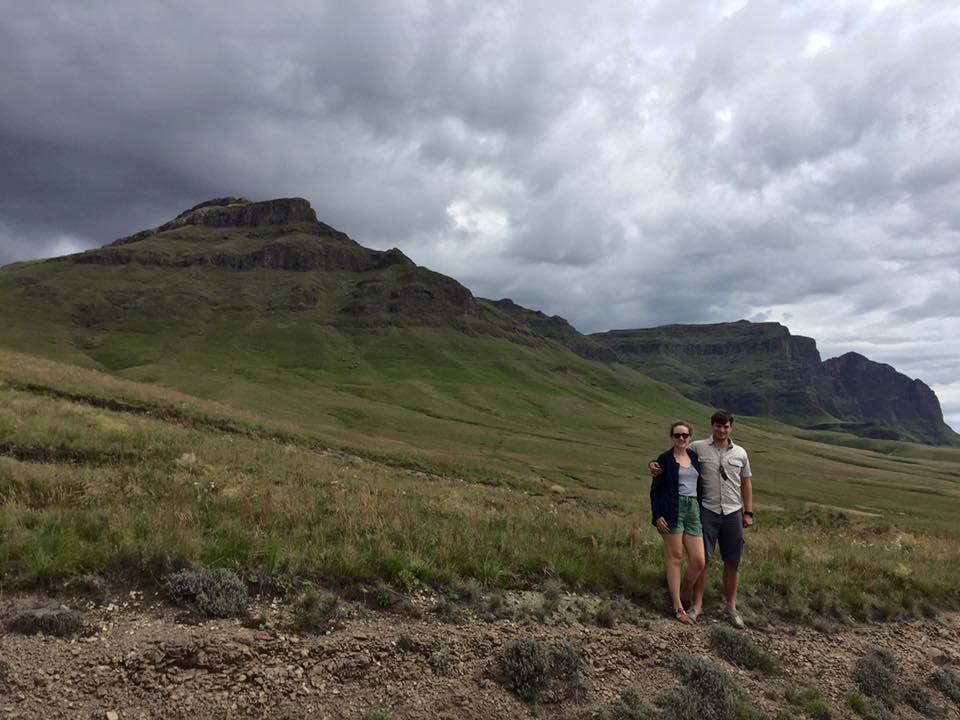
The Suikerboschfontein hiking trail offers some of the most beautiful landscape and vegetation that you’ll find within three hours of Johannesburg.
When you start hiking you’ll skirt a cliff, where you can spot bushman paintings if you squint. You’ll descend down into grassland, where unfortunately the impact of cattle farming is clear. The river valleys are also sadly overrun with wattle. This part is easy on the legs but not very scenic.

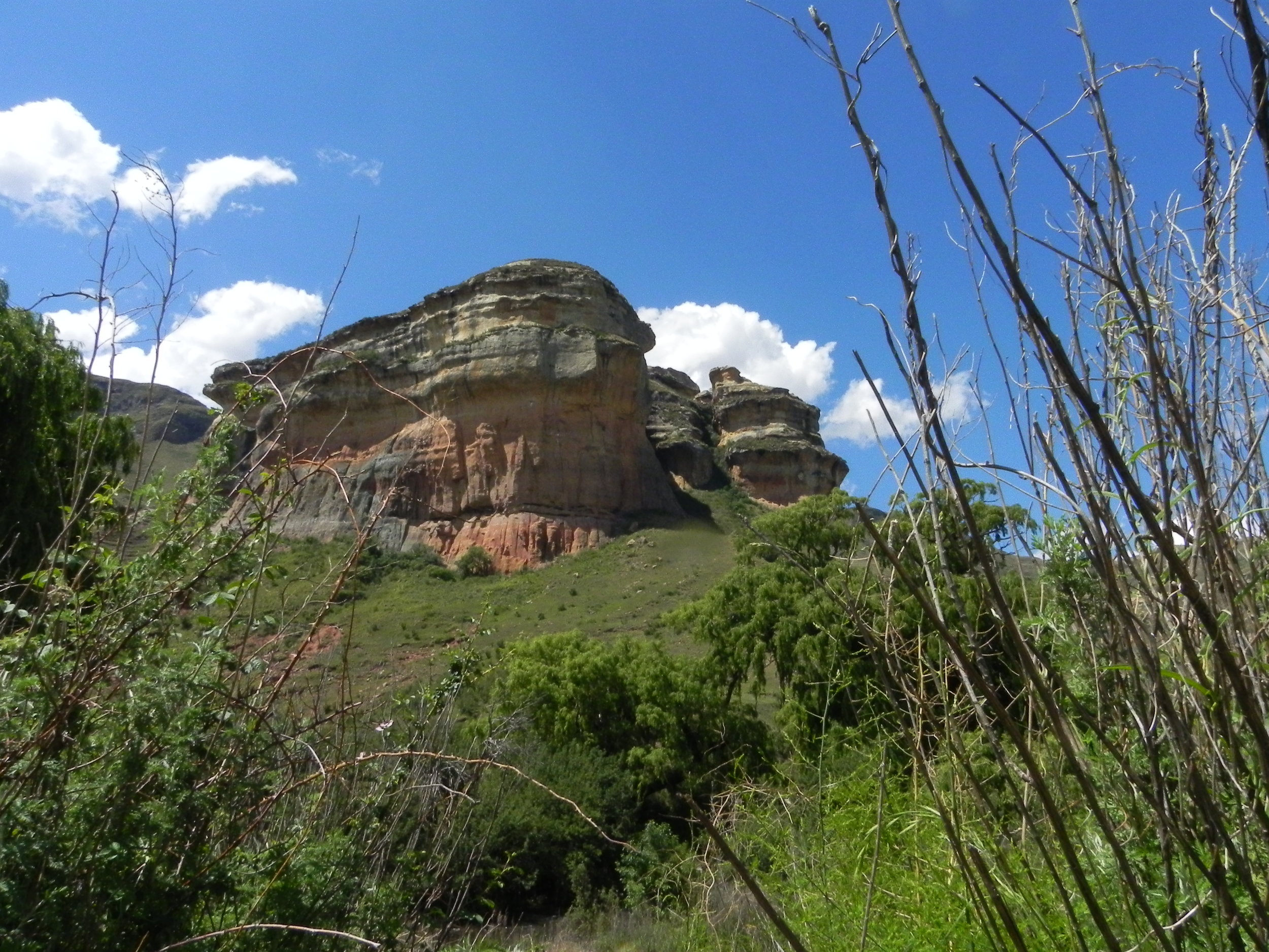
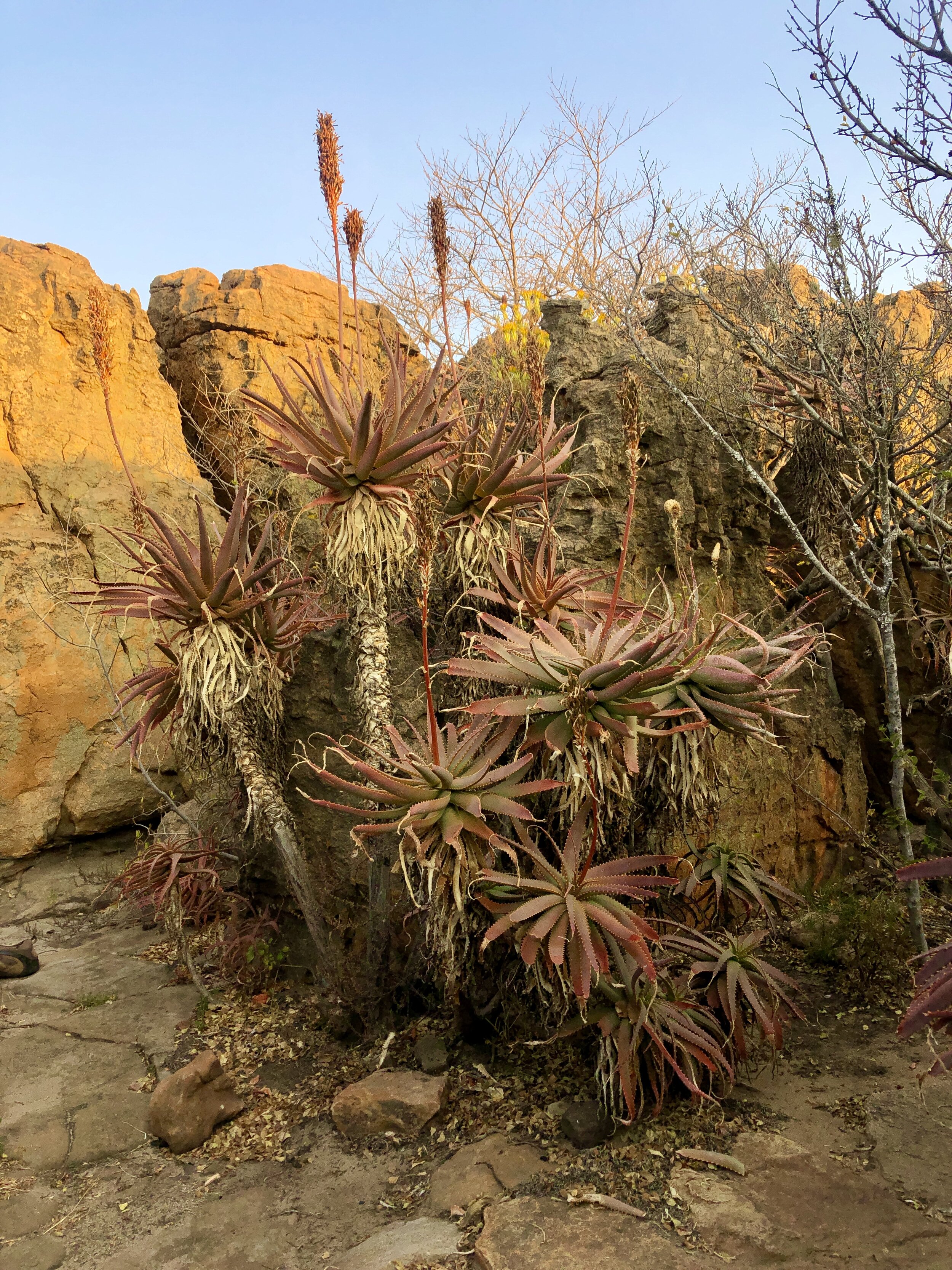
This changes when you cross a stream around lunchtime and enter the nature reserve. As you climb slowly you will be surrounded by incredibly diverse vegetation, rocky outcrops and remnants of iron age settlements. The cabbage trees, aloes and crystal clear streams are breathtaking. The bush is alive with birds.
As you approach the end of day one (around 9km) you’ll enter a pristine indigenous forest and hike up through a gorge following the course of a small stream. Take your time. Your legs will be tired and you’ll want to take in the magical nooks and crannies. Indigenous forests would have covered the highveld before cattle and man-made fires destroyed nearly all of them. Now only those tucked away in hard to reach spots remain.
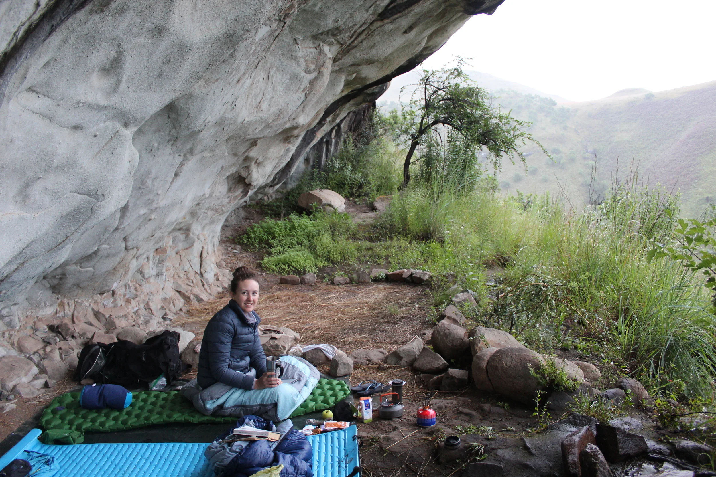
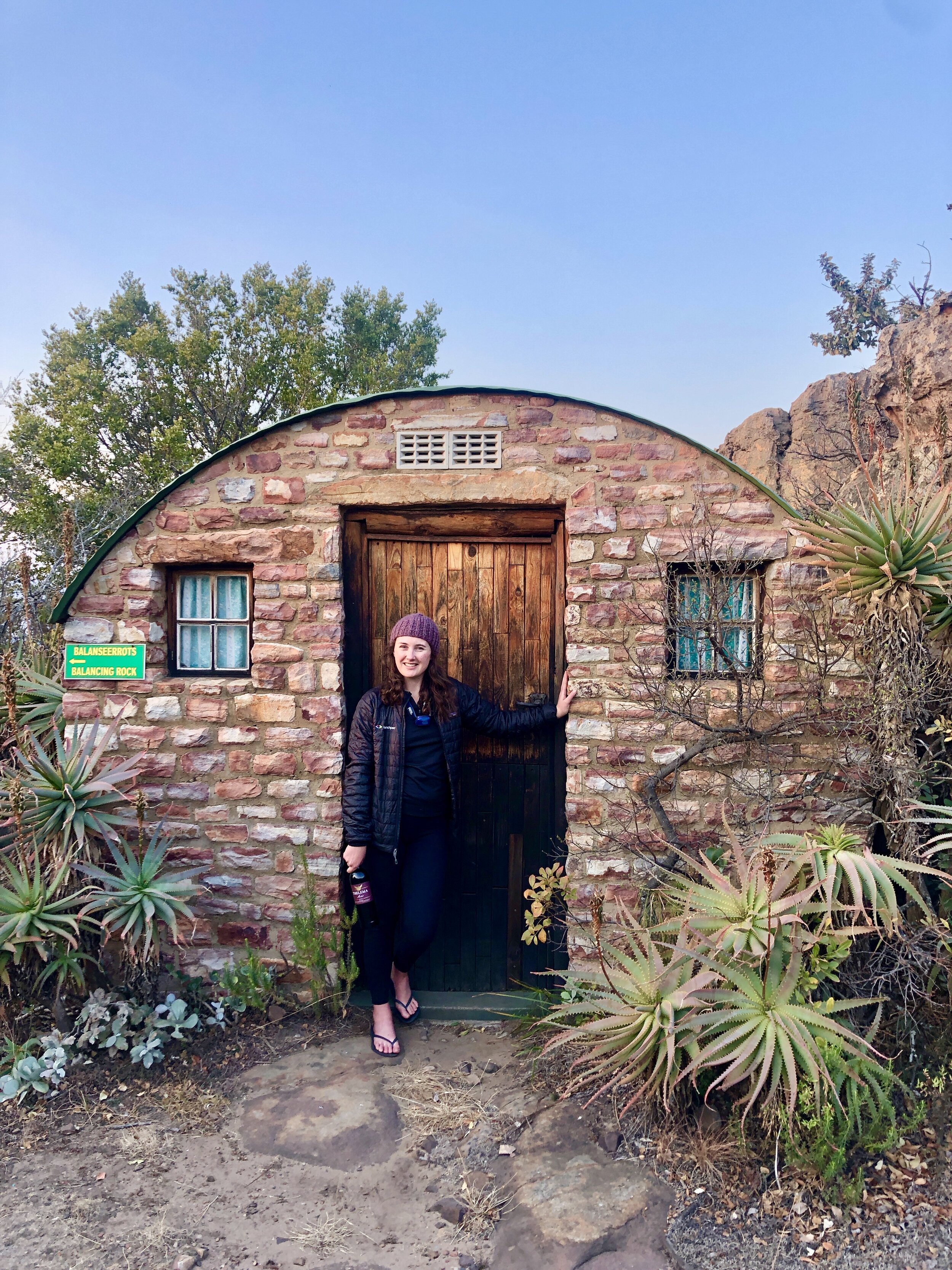
At the top of the gorge you’ll climb a couple ladders as you squeeze through a crack in the rocks. You’ll walk through rock pillars and grassland to your accommodation for the night: Rooikrans camp. It’s made up of stone huts cleverly built into the natural landscape. If you let your imagination wander you could easily be in a hobbit shire or on the moon. The huts sleep six in three bunk beds. They are clean and warm, even on a cool night in August.
We were welcomed into the kitchen and braai area by a couple of southern boubous - a type of bushshrike. They chatted away as we unpacked our food, clearly hopeful that our arrival meant dinner was sorted.
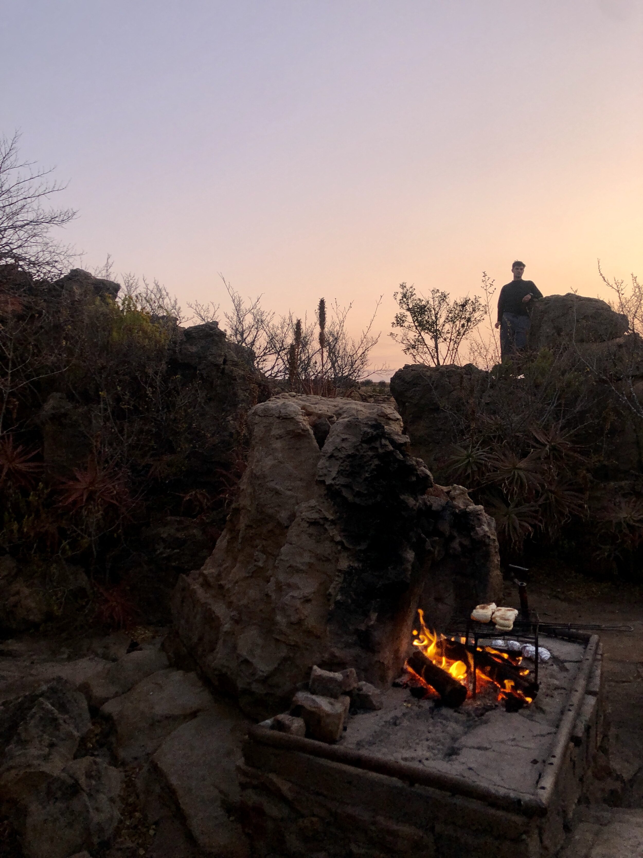
After catching our breath we lit the donkey boiler. You’ll want to get it going soon, as it takes a while to heat the water. There is nothing better than a hot shower with a beer after a long day hiking in the bush.
While we waited for the donkey to heat up we went to the outlook point. We enjoyed a few cold beers that one of our fellow hikers managed to squeeze into a backpack. Thanks Phil for supplying and carrying the beers!
Dinner was steak, baked beans and a few potatoes under the stars. We enjoyed a bottle of Thelema Merlot. It’s one of our favourite South African wines and was well worth the extra weight in our backpack.
Day 2
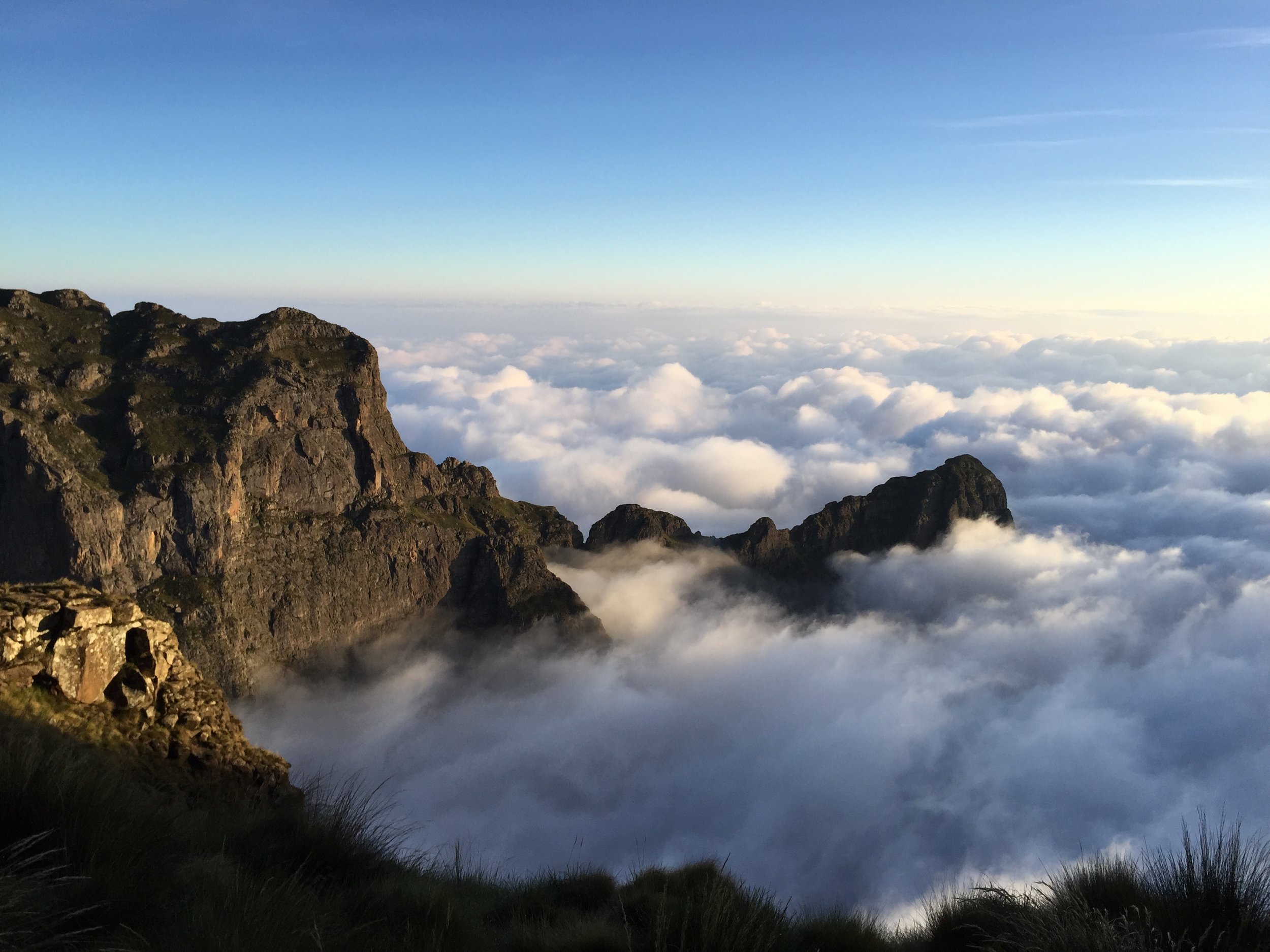
It’s good advice for any hike but especially true here: plan to get out early. Day two is the highlight of this hike. You’ll want time to stop, admire the views and explore. (Warning: Day two is longer than the 10km stated on the map. It took us about 6 hours, including 30 minutes when we got lost.)
We coaxed our weary legs out of our sleeping bags and headed to the kitchen. We made coffee with our aeropress, grabbed some rusks and headed to the lookout point. We looked down into the valley and caught a glimpse of the gorges we would spend the day exploring.

When you leave Rooikrans camp you’ll wind through a rock maze. Then you’re hopping and jumping your way across a series of rock pillars with the valley stretching out below you.
The first of many “wow” moments is when the path leads you to the edge of a huge gorge. As we skirted the cliff we disturbed a large flock of Southern Bald Ibis who were roosting on the rocks below us. This type of Ibis was a first for us. It is an uncommon resident and endemic to this part of South Africa. We were able to spot a couple nests with eggs using our binoculars.
Just before we climbed down into the gorge
Much of the route back is along and often through the river. Having spent the first day in the sun, day two is spent in the cool, damp forest. You’re surrounded by ferns, creeping vines and moss. You’ll need to take your time on slippery rocks, either scooting down on your bum or using a rope for help (especially in the summer when the river may be high). A couple wooden ladders down waterfalls and along rock ledges keep things interesting.
There are many crystal clear pools, where you can enjoy lunch and brave the cold water for a swim. Enjoy your time there, as you’ll soon be heading out of the cool gorge and start climbing again. We lost the trail just before the ascent due to too much chatting. So keep an eye on the white markers and look out for the sign post.
The rest of the way home is flat grassland and a few climbs down and up out of river valleys again. Tired legs from a day and a half of hiking can make this slow going.
If you’re struggling towards the end you can set your sights on the pool just before you get back to your car. It’s a bit murky but appears like an oasis after a long final uphill through a valley. Otherwise you can jump in the shower at the Oom Japie dormitory before starting your drive home.
Details
You need to bring everything with you: sleeping bag, food, drinks, quick dry towel and a change of clothes. Firewood is provided. We like to bring frozen meat and some tinned beans to braai at the overnight hut. You can let the meat defrost in your backpack while you hike.
The hike is booked through Fagala Voet. It costs R420 per person for the weeknd. Nadia at Fagala Voet is very helpful and can provide advice and additional information.
Do you want email updates when we publish a new blog post?
Sign up using the form on our About page.